 |
Turkey
September 18, 2007
Position N 35 53.7' E 030 42.4' at 0400 hours UTM.
|
We are 36 miles off the Turkish coast and should arrive at Finike around lunch time. All well on board.
later that day.....
1000 hours and we can see the Turkish mountains ahead. We also heard a very strange thumping noise as though
 |
someone was beating on the hull with their fist. We scoured the boat, inside and out, to locate the cause. We then realized that there were three vessels directly ahead of us that were firing some kind of quick-firing artillery at a distant target in the water. Binoculars showed them to be three patrol boat type vessels, painted white with a broad diagonal red stripe in the fashion of Coast Guard vessels. There were rocks and a headland to starboard but we nevertheless altered course to pass between them and the hazards. The three vessels totally ignored us as we passed about three quarters of a mile off their stern. We hailed them on the radio but they did not respond. We also watched very carefully to see which way their gun was pointing and to make sure that the smoke from their exploding shells was in the opposite direction to our passage.
At 1245 we motored into the marina
at Finike, Turkey and tied up at
the dock at N 36 17.7' E 030 09.0'
  |
September 19, 2007
Our
first night at Finike and in the
morning Annette asked me, "Did you
hear the gunshots during the
night?"
I had heard nothing. This is not
surprising since I typically do
not sleep well during the first
night of a passage and tend to
crash hard when we get to a
marina.
The town of Finike is set upon a
steep hillside with a backdrop of
high mountains. The homes are
stacked on the hillside, one above
the other, with steep flights of
stairs providing access for
pedestrians. The town has a series
of statues scattered along the
main thoroughfares and most of the
statues were of huge oranges. This
is a citrus growing region and
apart from agriculture, the town's
"other" industry of bars,
restaurants, travel agents and
gift shops is centered around the
marina. Unlike Cyprus, most of the
vessels are sail rather than
power, perhaps predictable with
fuel near US$8 / gallon. There is
a significant permanent
"live-aboard" community, plus an
ex-patriot contingent who live in
the town. WiFi internet connection
in the marina was free, glacially
slow and intermittent. We were
told that the problem is that
everyone in town knows the access
code to the marina WiFi and the
locals spend all day downloading
pirated movies and taking up all
of the bandwidth. When the marina
changes the code, the whole town
has learned the new code within an
hour and everything is back as it
was.
     |
We met fellow cruisers in quantity
for the first time since our visit
to Bali, Indonesia and joined one
table at the local watering hole,
"the Rose Garden". I had asked
where this was and if there was a
sign. I was told there was no
sign. It is called the "Rose
Garden" because it "once" had roses
growing there. We met cruisers
heading south though the Red Sea
and cruisers who were just heading
along the Turkish coast. Around
1900 hours there was a loud bang
followed by the aerial explosion
of a large firework. The mystery
of the night-time gunshots was
solved! It is Ramadan and the
evening firework signals the
faithful that the sun had set and
they can now eat. The morning
signal at 0400 hours is to signal
that they should get up and fix
their meal before sunrise begins
the daytime fast. I always slept
through both the fireworks and an
hour later, when the two adjacent
mosques would begin their dueling
asynchronous wailing, calling the
faithful to pray.
September 20, 2007
Lazy day; Laundry and boat chores. We wandered around town window shopping but in the evening, we barbequed steaks aboard DoodleBug for supper. Sometimes you just have one lamb kebab too many.
September 21, 2007
This
morning we set sail at 0720 hours,
bound for the anchorages at "Gekkaya
Limani". We took on some diesel
and for the next three hours this
was a very pretty "motor" along
the coast with winds of one or
two knots. We passed increasing
numbers of Turkish gulets. These
are large wooden sailing vessels,
schooner rigged, with curving bow
and long bowsprits. I say "sailing
vessels" but most of them had no
sign of any sails or running
rigging. They are designed and
used strictly for the local
tourist industry and motor from
bay to bay. Our destination was
some 13 miles east of the marina,
in a protected bay tucked behind a
couple of islands. The cruising
guide warned of a power cable
across one narrow entrance but
stated that it was reported to
have been removed. It's previously
reported height was "20 to 30"
meters. Since that is within the
range of our main mast, we kept a
careful lookout as well as a
lookout for rocks in the narrow
channel behind the island. Sure
enough the overhead wires came
into view. If they had been
removed, they had since been
replaced. We reversed our course
and circumnavigated the island in
the opposite direction to find a
quiet spot to anchor in the small
bay beyond the overhead wires.
We launched our dinghy for the
first time this season and the
outboard fired up immediately. We
first visited a large sea-cave
that we had passed on our
approach. We were able to dinghy
right inside the cave and explore
it's depths. We had been inside a
few minutes when a small power
boat entered and took up position,
partially blocking the entrance,
while it's passengers slipped over
the side to swim in the cave. Next
a huge bowsprit appeared above the
power boat as a much larger power
boat poked it's bow in to the
cave. All of it's many passengers
were clustered on the bow taking
photos.
We continued our exploration of
the island and next visited an
abandoned looking resort. The
guide book mentioned obnoxiously
loud disco music into the wee
hours emanating from this
establishment. It must have been a
while ago, as the roofs were partially
collapsed and the only sign of
life were a couple of feral
peacocks wandering amongst the
debris. There was a truly ancient
water cistern, partially roofed
with blocks of limestone over a
supporting arch of smaller
limestone blocks. The cistern must
have dated to Roman times and had
been in use by the resort. We
passed a power panel and I noticed
that one of the meters showed
voltage and there was the hum of a
transformer. Those low power
cables across the channel were
live!
      |
We had noticed ruins near the
summit of the island and began to
bushwhack through the undergrowth
and over the rough limestone rocks
towards the nearby peak. The views
were magnificent with DoodleBug
quietly at anchor in the blue of
the bay below us and all of the
inlets, rocks and channels spread
out for our view. When we achieved
our summit, slightly scratched but
triumphant, we discovered we were
on the wrong peak. We could now
see the "correct" peak and also a
trail to it's summit. We regained
the abandoned resort, chased the
peacocks around trying to get a
photo and motored our dinghy
around the island to the "ruin"
trail. The ruins were much more
elaborate than I had originally
thought from below. They were on
the opposite side of the island to
the failed resort and also had a
huge and ancient cistern. There
were hoses and a pump indicating
that this cistern had also been in
use by the resort. The
architecture of the ruin seemed to
be a mixture of styles dating from
different periods. Who had built
it and why? There had been a lot
of labor expended to build the
various walls, and the several
ancient buildings. The islet had
almost no arable land except for a
tiny plot near the resort. There
must have been a sizeable
community living at the ancient
site but doing what? There was no
road to protect amongst the rugged
Turkish mountains. An ancient
naval base? That evening the bay
around us began to fill with tour
boats who anchored close to the
shore and ran a long line to the
nearby rocks. We had anchored in
the middle of the bay and were
clear of everyone as we watched
multiple barbeques being fired up
on the various boats as their
evening lamb kebabs were being
prepared. Great Day. Position N 36
12.7' E 029 53.6'
September 22, 2007
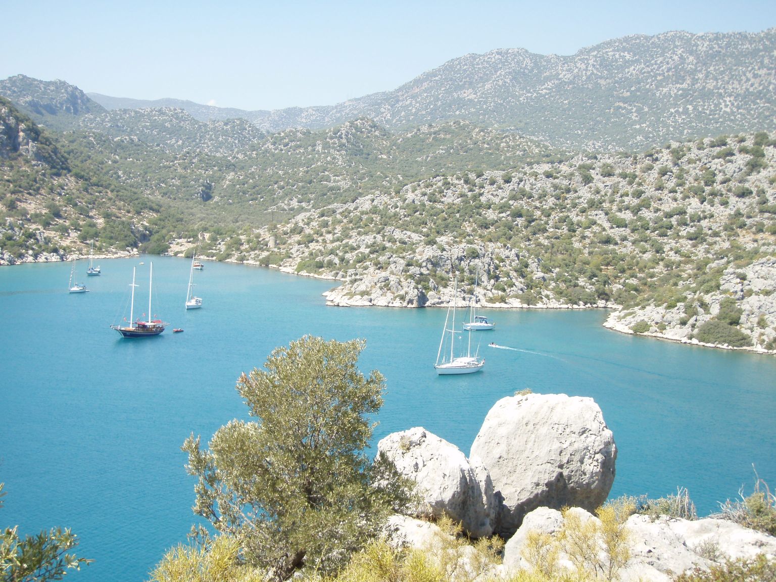
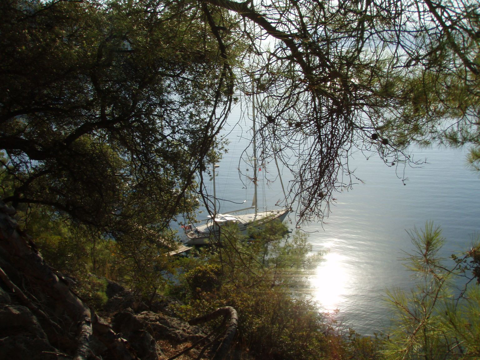
This morning we moved perhaps four miles to an anchorage off the village of Ucagiz. Gekkaya Limani anchorage was just inside the east end of Kekova Roads. This is a channel behind a long skinny island just off the mainland and which provides a series of
very pretty and well sheltered anchorages. As we motored in the dawn light, we passed a large castle perched on the steep ridge of Kale Koy. We turned through a narrow entrance between rocks into the bay beyond and anchored next to an Amel54. This is the first "54" we have seen "in the flesh" and is Amel's new model. They no longer build the Super Maramu (DoodleBug is a Super Maramu, hull #331).
    |
We dinghied over to Kale Koy, tied up to a restaurant dock and began to climb the steep pathway between competing gifts shops towards the castle. We had been warned that we would have a guide whether we needed one or not. Sure enough a young girl, perhaps 12 years old, attached herself to us. She had a basket of "crafts" such as shell necklaces and cloth bags decorated with same and which she claimed to have made herself. We reached the battlements of the castle and she made her serious pitch for us to buy some of her wares. I thanked her, said we did not need anything and gave her 5 Turkish Lira (about US$4). She was not happy with this and left muttering.
    |
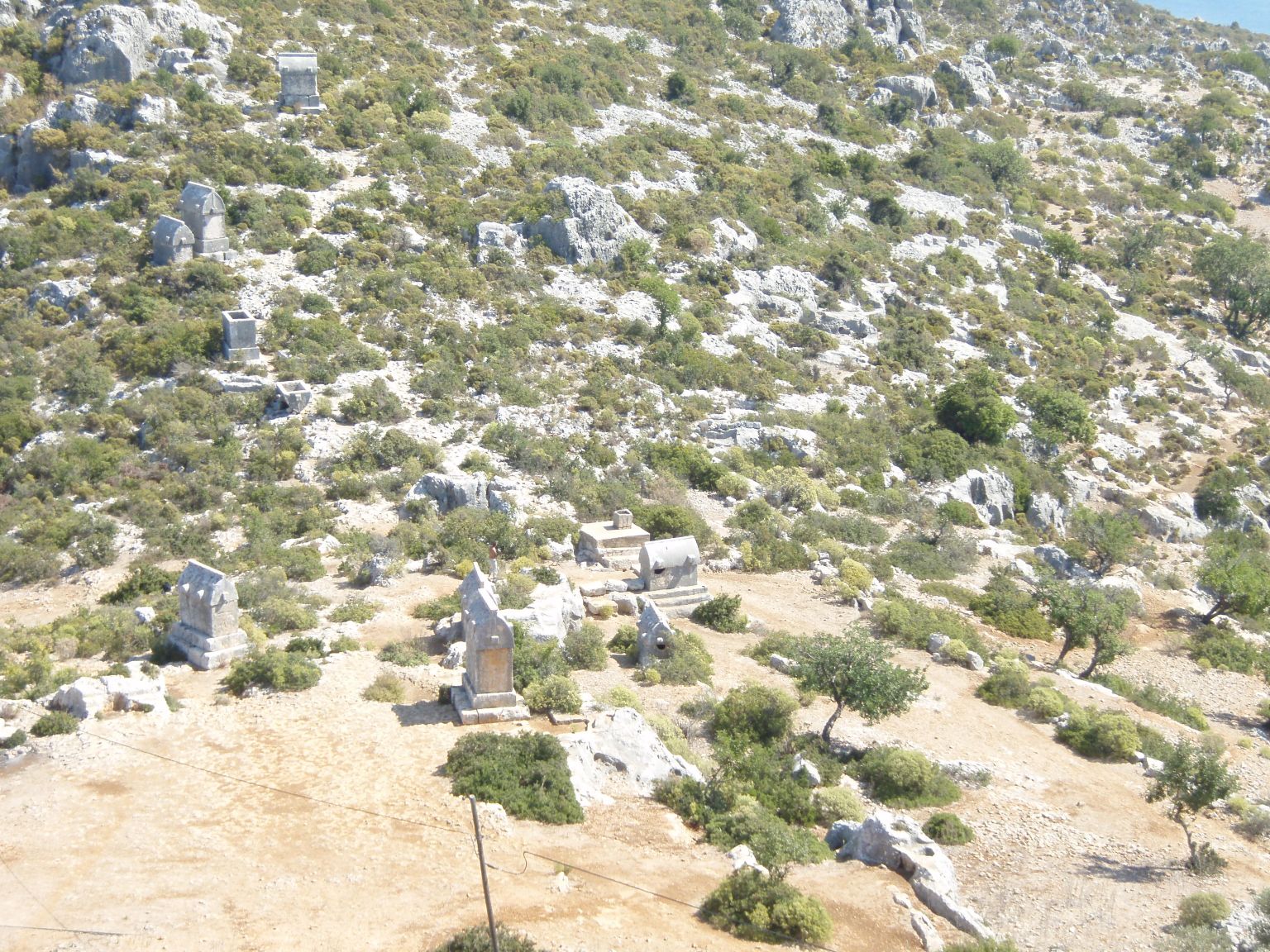
The Crusader castle walls were
amazingly intact and the view
across the bays and channels
magical. We could look down upon
the ruins of ancient Simena and
see where the current crop of
restaurants are built upon the
ancient wharf. The old city is
partially submerged with
sarcophagi sticking out of the
water like mooring buoys. (This of
course is entirely due to Global
Warming - probably due to the
excessive burning of Christian
martyrs by the Romans).
We next visited the village of
Ucagiz on the far side of our
anchorage. The approach to the
piers was jammed with tourist
boats - Gulets and swarms of
sea-kayakers. This village is a
major staging area for these tours
and motor-coaches filled the
parking lots waiting for the
returning voyagers. We watched
from a pretty little restaurant (Onur
Pension and Restaurant
www.onurpension.com) and enjoyed a
superb lunch. I had the Sea Bream
and Annette had grilled eel.
 |
That evening we were invited
aboard SV Cerise (the Amel54), for
sundowners. We had a very pleasant
visit with Terry and Margaret, the
new owners and were impressed with
the many improvements that Amel
has made. We are duly envious and
toy with ideas of upgrading.
Current position is: N 36 12.7' E
029 53.6'
September 23, 2007
We raised anchor at 0640 hours and three hours later, dropped anchor in Bayandir Limani at N 36 10.6' E 029 38.7' in a small
 |
bay opposite the town of Kas. We lazed around all day just reading, swimming off the boat and generally relaxing. This is a pretty location, with vertical sea cliffs on the far side of the bay. In the cliffs we can see caves and sarcophagi. These look like rooms carved directly into the sheer cliff face. North of us, the town of Kas plunges down the hillside to the sea, with a backdrop of dramatic mountains. By night the town is a fairy sprinkling of lights in the distance.
September 24, 2007
We have shaken off yesterday's lethargy, launched the dinghy and set out for Kas. We circled the inner harbor looking for a landing spot and had to dodge the torrent of exiting tourist boats. Finally we found a spot and tied up next to what looked like a Mongolian Yurt - a sort of tent. We later found out that this strange object contained fishing nets. We wandered the town and had breakfast at a cafe near the harbor. The waiter told us that he was a Kurd from Mesopotamia. Near the end of our meal he asked me if we could help him. He knew we are Americans and explained that since the involvement of the USA in Iraq and Iran, the Kurds, amongst others, have been flooded with funds from the good 'ol USA. Unfortunately they had been given "million dollar" notes and were having great difficulty getting these changed to smaller denominations. He and his friends had acquired 13 of these bills and if we could help him and his associates out, we could keep half off the money. Wow! 6.5 million dollars for helping someone get change. Fifty percent is very generous because the Nigerians typically only offer twenty percent. Mind you, the Nigerian hoard they are trying to launder is usually at least 40 million, so I suppose it is fair. Volume discount and everything. Now Annette and I are way too busy to bother with small change like US$6,500,000 so if anyone wants to help this fella out, just let me know and I can send you his e-mail. He at least was deadly serious and we shook him off with difficulty.
    |
On the West side of Kas is an
amphitheater dating to 200 BC that
remains in remarkable condition.
We walked over to view this
antiquity and clambered over the
"seats" made from limestone blocks
to sit and view the stage. The
amphitheater faces the sea and the
view is unique. For hundreds,
perhaps thousands of years,
performances have been held here.
A magical place.
In the afternoon, we toured the
sea cliffs opposite our anchorage.
At one spot we found a tiny beach
where we were able to land our
dinghy. We bushwhacked up a steep
hillside until we came across a
trail marked with paint flashes.
The marked trail first led to a
huge cave with a hidden side
entrance tunnel. It was hard to
tell if it was completely natural
or if the entrances were man-made.
After exploring the cave, we again
followed the trail but decided
that it was now heading towards a
distant resort. As we backtracked,
the trail began to climb the sheer
cliff face along narrow ledges.
This was exciting as the sea was
now below us. We suddenly rounded
a flake of rock and found ancient
tombs carved in the solid rock of
the cliff. The outer faces
   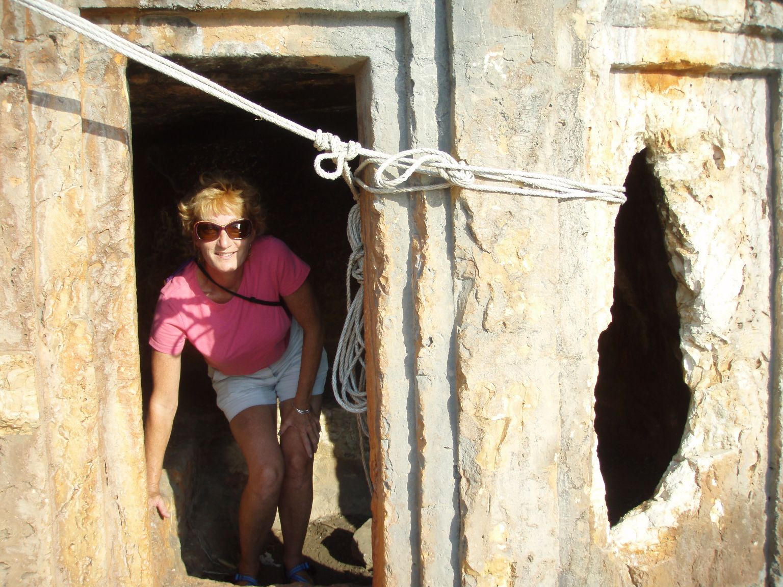      |
of the
tombs were inscribed in a Hellenic
script. The sides had the carved
shapes of pillars with the
appearance of a "roof" of vega
like beams. The cylindrical logs
projecting from the cliff-face
were carved from and an integral
part of the solid rock. The trail
continued upwards past another
tomb and now clung precariously
along a narrow ledge. Someone had
hammered a steel spike into the
rock and had festooned a rope
handhold along the cliff, to which
we gratefully clung as we edged
our way. Up and up the trail led,
zig-zagging amongst narrow defiles
and between rock-flakes. We heard
an ominous buzzing sound and after
convincing ourselves that Turkey
probably does not have rattle
snakes, we turned a corner to find
a steel tower perched on the cliff
edge with buzzing power cables. We
edged past this modern human
artifact and found ourselves on
the cliff-top next to several huge
stone sarcophagi. These were
easily large enough to have held
the Ark of the Covenant but
careful examination showed that
they had already been robbed, long
before Annette got there.
When we regained our dinghy, we
motored over to a nearby dock and
confirmed that the restaurant was
open that night. Here we met with
a fellow sailor, who had been in
some distress last night. He is
single-handing and could not find
a spot that would hold his anchor.
I had told him of this dock and he
had gained it's sanctuary in the
fading daylight. We sat and
chatted with Dennis and discovered
that he is a retired Turkish naval
officer. We had a fun dinner while
we discussed the Kyoto treaty, who
are the candidates in the
forthcoming US election and who
will win. What the electoral
procedure is regarding primaries.
Why Turkish and American relations
have deteriorated over the Kurds
and so on. Dennis is a sharp and
well informed man and we had an
enjoyable and lively evening. I
ate the shrimp casserole for
supper and it was tasty. Annette
did not enjoy the calamari and
said it tasted like old rubber
bands. Calamari always tastes that
way to me.
September 25, 2007
This morning we raised anchor at 0845 hours and motored in very light winds to Yesilkoy Limani, a bay just across from the town of Kalkan. We dropped anchor three hours later at N 36 15.5' E 029 22.2'. The cruising guide stated that we needed to use a long stern line ashore and sure enough, that is what most vessels were using. Now DoodleBug has never used this method of
     |
anchoring before but we
were nevertheless prepared with
line, chain to wrap around the
rocks, wrench to tighten the
shackles etc. We launched our
dinghy before we go too close to
the shore and then dropped anchor
as we reversed towards the shore
and the rocks. The first problem
soon became apparent. If Annette
is on the bow, testing the tension
of the anchor chain with her foot,
to see if the anchor is holding or
merely skipping over the sea bed,
who is watching the stern to see
if we hit a shoreside rock? From a
center cockpit yacht, the near
stern cannot be seen. We had
several attempts to hit a
combination where the anchor held,
we had enough chain let out and we
had not run aground. We never
could seem to get all three to
work at the same time. Finally we
had the anchor set and DoodleBug
was blown by the wind, parallel to
the shore. I got in the dinghy
with my "rock wrapping" chain and
Annette fed the line to me from
the stern as I motored towards the
shore. I pulled and motored but
there was no way I was going to
turn DoodleBug with a dinghy, so
that the stern was pointing at the
shore. Time to change plans. I
motored over to a French flagged
vessel nearby and asked how it was
done. The couple there explained
that you need a very long line.
The wife rows the line ashore and
then her husband winches the boat
into position. We never considered
"rowing" our dinghy because a) we
are Americans and b) our oar was
stolen in the Maldives. The
Frenchman also warned me that the
wind would change and suggested I
simply anchor and forget the whole
stern line thing. This we did.
Next task was to feed my wife some
lunch and we dinghied a mile or so
to nearby, Kalkan. Out of the
shelter of our anchorage the seas
were rough and although the chop
was no more than two feet, this
feels like twenty feet when you
are being bounced around in a
dinghy. The guide book had
suggested we would find many
upscale restaurants near the sea
front. Indeed there were lots of
restaurants but with few
customers. Our waiter recommended
Turkish pizza (pide) for lunch and
it was quite good. We wandered the
town and found it charming. It was
originally a Greek town but was
resettled with Turks in 1922. A
1958 earthquake flattened the town
and the survivors were relocated.
The old town was discovered by
developers who renovated and
remodeled the damaged buildings.
The current town is described as
being suitable for "comfortable
travelers". This means, other than
backpackers. We toured the many
gift shops and occasionally looked
at the real estate offerings.
There are real estate offices
everywhere. The store keepers
seemed very laid back and one
explained to me that the season is
over. He said in another week to
ten days it will start to rain.
From then on winter sets in and
the town is completely dead.
We headed back to DoodleBug and
discovered that there were now 17
boats in the anchorage, most of
them tourist gulets. They were all
jammed together along the beach
with long lines ashore. The only
space left was around some
American flagged vessel that was
not using a stern line, thereby
taking up an inordinate amount of
prime anchorage space.
September 26, 2007
One of the reasons we did not want to fool around with stern lines was simply that we intended to leave our anchorage as close to 0400 hours as we could manage. The idea of unwrapping chain from shore-side rocks in the dark at at 0400 hours, retrieving a long line and then lifting the outboard and dinghy to stow them for passage, was not enticing. As it was, we had a huge Gulet moored across our stern and they partied heartily until the wee hours. I just wish our anchor windlass and bow thruster had been a little noisier when we left at 0430 hours and set off for Fethiye. This technique of early morning departure and then motoring, seems to be the norm for Turkish cruising. We met a couple who maintained that this was their second season "sailing" here and they had yet to unfurl their sails. The prevailing wind is from the West and since this is the direction we are heading, we might just as well motor into a very light headwind, rather than fight a strong headwind later in the day. This we did and experienced light winds of around two knots and a two foot swell. We dropped anchor in Fethiye Bay at 1125 hours at N 36 37.5' E 029 05.8'.
September 27, 2007
This morning we had caught up on some sleep and were all fired up to explore Fethiye. We had two minor errands to accomplish and one of these was to find a cardboard box in order to ship a "dragon" kite that Annette had bought in Bali and which has been
 |
occupying our
forward "V" berth. The second task
was to see if we could locate a
marine supply store, to sell us
one or more dinghy oars and
thereby upgrade our dinghy manual
power system from a single oar to
a pair. The missing oar had been
stolen at Cocos Keeling as part of
last year's Ramadan celebration.
We asked at the tourist
information center if the stores
would be closed on Friday and if
there were any holidays when
everything would shut down. The
"information" lady responded
haughtily, "Certainly not Madam.
This is not Arabia, you know!"
Everyone we asked regarding
cardboard boxes directed us to the
Post Office. Now we have been
through this before. At the Post
Office they look at you with
bewilderment and then offer you a
crummy mailer you couldn't fit a
pair of ice skates into. Ditto on
the oars. We did a lot of miming
of the Olympic men's singles but
nobody had any oars.
     |
Lunch was fun. There were a couple
of restaurants inside the fish
market. You buy your fish, have
the fishmonger clean it for you
and then deliver the remainder to
the restaurant. They cook it for
you and charge you a set up fee
which includes salad, bread and
the like. It is BYOF. Annette
insulted several fishmongers by
carefully examining their wares
and then rejecting their fishy
offerings because she did not like
the look of the eyes and gills.
Finally she found the fish she
wanted, a pair of sea bream. She
also bought a half kilo of
sardines and the successful
salesman gave her a rag to wipe
her hands on, that if anything,
was more slimy than the fish she
had been handling. Lunch was
excellent despite the ridicule I
endured from my wife because I
don't eat the heads of the
sardines.
That evening the anchorage was
unbelievably noisy with multiple
Mullah's wailing, "Get up and
pray!", or whatever. Some one ran
a misfiring diesel with no muffler
on it around the anchorage at 0300
hours. This not only woke us up
but also every dog in Turkey. The
canine complaints echoed around
the bay for the next hour.
September 28, 2007
We
awoke tired and grumpy after a
disturbed night. The deck was
soaked with condensation and the
weather forecast predicted a
strong blow from the north
tonight. We decided that we had
already seen Fethiye and at 0725
hours, raised anchor to set sail
for Gocek.
We anchored off Gocek town's beach
at 0925 hours at N 36 45.2' E 028
55.9'. The spot we have selected
has clear deep water behind us and
both the north and west are
protected by mountains. These
should shelter us from the
expected wind tonight.
September 28, 2007
Today I found the Post Office and
mailed a batch of Annette's
postcards for her. On my return, I
spied a marine supply store and to
my delight, found and purchased
two dinghy oars! It has been
twelve months since we owned a
pair and we can now row our dinghy
in other than tight circles.
We also found a cafe that offered
free Wifi internet access and were
able to check our various "land"
e-mails.
 |
The Amel54 "Cerise" was also at
Gocek and we invited Terry and
Margaret aboard DoodleBug for a
supper of barbequed steaks.
Annette had bought a five year
supply of steaks from the
Supermarket in Ashkelon and we
needed to eat the pile down a
little. Actually it has been fun
barbequing for a change. The story
of our "Force 10" barbeque has not
been a happy one. It is a
marinized version of a barbeque
and is fueled from a propane
cylinder. It is usually seen
mounted on the side rail and
occasionally the stern rail of
yachts. In such a position, the
merest, slightest whisper of the
balmiest breeze will blow the
gosh, darned thing out.
Re-lighting has produced
spectacular explosions, to the
extent that lighting it has become
the prerogative of the Captain
alone. We had also bought a cutesy
little tripod stand in vain dreams
of carting the thing ashore onto
some tropical beach, in order to
barbeque a delicious meal under a
star filled sky. Because of it's
capricious and explosive nature,
we usually kept the malicious
device chained up in the side
locker. We had resurrected it in
Ashkelon and had several excellent
barbeques with the unit set up
behind the Men's toilet block.
Does not match a South Pacific
beach at sunset for romance but
the meat got cooked and the thing
stayed lit. After several
successful meals we were in Turkey
and it was way too far to the
Men's toilet block, when the
barbeque feeling stole over
Annette. We set the barbeque up on
it's tripod on the Mizzen deck,
directly on the edge of the
cockpit and on a towel, so as not
to mar the gel-coat. Perfect! It
has taken us four years to work
this out.
That night the "blow" arrived as
forecast but we were well
anchored, clear of other vessels
and in the shelter of the nearby
hills. I would have slept right
through the night, except that I
had not allowed enough scope on
the GPS anchor alarm and it went
off around 0200 hours, as the wind
changed direction and Doodlebug
swung with it.
September 29, 2007
Today we did some boat chores. For me, this meant a changed fuel filter and for Annette, it was several loads of laundry. Later we wandered through town, shopping for gifts. We were attracted to a restaurant that had all sorts of ambience and truly disgusting food.
September 30, 2007
One
bad meal and we blew off Fethiye.
That's the kind of fickle people
we are! We raised anchor at 1020
hours bound for "Tomb Bay" and
began the anchoring process at
1150 hours. Our position was N 36
41.6' E 028 52.0'
The guide book insisted that we
use a stern line and as all the
other vessels were doing this, we
rigged ourselves ready. We dropped
anchor in 60 feet of water and
began to back down towards the
shore. Almost immediately we were
in very shallow water so we
motored forwards to pick up the
hook and try another place. As we
were maneuvering, a British
flagged yacht began to anchor less
than a boat's length from us. We
were more than a
little surprised,
since it is sailing etiquette that
a second boat waits until the
first boat is fully anchored
before anchoring themselves. We
dropped again and backed down
letting out 95 feet of chain.
Again we were in very shallow
water but the anchor was solidly
held. I rowed our dinghy ashore
with our new oars and tied off a
line to a rock. We looked as
anchored as anyone else but I was
distinctly unhappy with the
situation. The anchor chain lay
down a steep slope and had been
dropped in 60 feet of water. This
is a scope of 1 to 1.5. We will
use a scope of 1 to 3 for short
periods but 1 to 5 is our normal
minimum and 1 to 7 if the weather
is acting up. I swam over the
anchor and it looked well set.
There were four other vessels
anchored nearby in virtually
identical circumstances.
Nevertheless we dinghied ashore
and walked over to a nearby bar /
restaurant that had a dock. The
proprietor said there was a single
spot left on his dock and we could
have it if we were there within
the next ten minutes. By the time
we returned to DoodleBug, our four
neighbors had left and the wind
was blowing us towards even
shallower water, although the
anchor had not budged. Within ten
minutes we were backed down
and tied up at the restaurant's
dock having picked up the last of
the laid bow lines.
Later that afternoon we were
astonished to find a German yacht
squeezed between us and our former
neighbor. He had used his anchor
in the absence of a bow line but
his fenders groaned against us all
night as we each moved. The
restaurant made up for the
previous night's crappy meal with
an excellent pair of Sea Bream.
One of our new neighbors came and
introduced himself to us.
"Christian" commented that it was
very unusual to see Americans
cruising in Turkish waters and
that his group had been discussing
why there were only two people on
such a big boat. We were polite.
October 1, 2007
This
morning we watched a small group
of goats climb down the steep
hillside and attack the nearby
trash dumpster. Their little neck
bells reminded us of scenes from
"The Sound of Music", although
there was no hint
of Julie Andrews in their eating
habits.
  |
After watching the goats, we were
inspired to climb the hillside
ourselves in search of more Lycian
rock tombs. We had a good climb;
the views were fantastic; again we
climbed the wrong cliff.
Nevertheless we reached the
dock in safety and even passed the
dumpsters without feeling a twinge
of hunger. We have seen virtually
no wildlife in Turkey. No
squirrels. No sign of any mammal
other than goats and donkeys. We
have seen one or two small lizards
and some frogs in Finike but
that's about it for reptilian
life. We have seen small fish in
the waters but very few sea-birds
and only a small handful of
songbirds. The Bays themselves are
gorgeous with tall pine
forests and steep limestone cliffs
reaching right down to the water's
edge. The waters have been clear
and just occasionally polluted
with tourist trash such as plastic
water bottles.
At 1000 hours we slipped away from
the dock and motored over to
Sarsala Koyu Bay, anchoring at
1100 hours at N 36 39.5' E 028
51.1' Again we had a stern line
ashore and managed to achieve a 1
to 3 scope on the anchor
  |
chain.
About an hour later a large
catamaran anchored nearby. We were
interested to see that it was
flying a large American flag.
There were 8 people on board but
the language being used was not
English and seemed like a variant
of Italian. We were then amazed to
note that their American flag was
the Stars and Stripes on one side
only. The other side of the flag
was blank. One side USA - the
other side white. Was this a
political statement on American
foreign policy?
I cleaned the propeller that
afternoon, as I have been trying
to diagnose low engine RPM before
we arrive this season's
destination of Marmaris. I have
tried changing every fuel filter
and although the propeller blades
looked clean, I used a scuba tank
and spent 45 minutes with scraper
and steel wool removing residual
barnacles.
In the meantime, several large
power boats had entered the Bay,
anchored and then discharged
smaller power boats with
water-skiers. These latter
proceeded to run at high speed
between and around the anchored
yachts until late evening. We were
protected from being
circumnavigated by our shore tied
stern-line but the nearby
catamaran had no stern line and
was being regularly orbited.
Dusk finally brought peace to the
anchorage with bats flitting
through the tree-tops. We rigged
for mosquitoes with nets over the
windows but were not bothered.
October 2, 2007
The guide book had claimed that Seagull Bay to the south of us was not frequented by tourist Gulets and we raised anchor at 0840 hours to check this out. There was a small dock at the head of the Bay near a huge
      |
hillside display of a diving seagull. We tied up at this dock at 0940 hours at N 36 38.1' E 028 52.8'. We then met "Amed", the seagull artist and proprietor of the nearby restaurant. Amed said that he had created the seagull art about five years ago, as a protest against the polluting of nature. There did indeed seem to be less trash in this bay, so perhaps Amed's scheme has worked.
    |
We set off that afternoon on a
hike to discover the nearby ruins
of an ancient Lycian town. The
trail climbed the steep hillside
through a dense stand of pines on
the far side of the bay to our
dock. The shade was welcome as we
toiled upwards, while enjoying the
views of the blue waters of the
bay below. At the top of the ridge
we were climbing, there was a
cluster of rude shepherds
dwellings. There were signs of
recent occupation, although not a
soul around. Our trail then
crossed the shallow valley in
front of us and continued through
more woods up the flank of a
higher ridge. Finally we reached
the summit of the mountain ridge
separating the different bays and
on the flattish area at the
summit, we found the ruins of a
large stone sarcophagus, plus the
rubble of several ancient
buildings. The ancient town was
associated with the nearby Roman
settlement of Lydae.
From our summit we could see most
of Fethiye Bay with its calm
waters and sprinkling of the white
sails of yachts. On our return
hike, Annette found a large quill,
9 inches long, of what Americans
would identify as a porcupine.
There was also nearby evidence of
"rooting" around some of the
rocks. Do they have porcupines in
Turkey? Nevertheless, this is the
first sign of native mammal
activity that we have found.
 |
Later that evening a Finnish boat arrived at the dock and we shared a table with them for a meal at Amed's restaurant. They were a fun and lively group and we thoroughly enjoyed our visit.
October 3, 2007
The
plan today was to sail for
Kizilkuyruk Koyu, the last small
bay before re-entering the "open"
Mediterranean waters and heading
west again. We motored off the
dock in Seagull Bay at 0900 hours
and passed between the island of
Domuz and the mainland, through a
really narrow passage. The
guidebook did not actually say if
this was possible and the chart
was ambivalent on the issue. I was
therefore comforted to see a
tourist Gulet take the same route
about a mile ahead of us. A quiet
morning and a pretty motor with
virtually windless conditions. We
reached our intended destination,
just over an hour later and found
it crammed with other boats of all
kinds. A quick look and we decided
to reverse our route and try the
previously passed bay of Kuecek
Kuyruk. We dropped anchor at 1045
hours at N 36 37.8' E 028 52.7'
and ran a stern line ashore. This
time we were about 4 to 1 scope on
the anchor and felt like we might
be getting the hang of this
technique. Of course the seabed
here was nowhere near as steep as
the other places we had been.
An hour or so after we had settled
in, the wind began to blow. I had
checked the weather forecast this
morning and expected to find
ourselves nicely sheltered. We
were not. The wind was not
particularly strong - 10 plus
knots or so - but it was blowing
directly along the axis of the
tiny bay we were in. By 1400
hours, DoodleBug's bow was
beginning to plunge to the small
wind generated waves. We were on a
lee shore with rocks about a
single boat's length behind us and
a rising wind. So much for weather
forecasts. At 1415 hours we had
retrieved our
 |
stern line and
raised anchor, setting sail for
Ekincik Iskelesi, twenty plus
miles to the west. We motored with
the Genoa and main, close hauled
in ten knots of wind, as we wanted
to arrive while there was still
light. For the first time in weeks
the sky was perhaps 4/8ths cloud.
The day was very hazy and
visibility was such that we could
no longer see mountains that the
radar showed were but 6 miles
away. We have noticed the hazy
skies that began as we entered the
Red Sea. There we attributed most
of the haze to blown sand, of
which there was still lots of
evidence on DoodleBug's deck and
rigging. When we had made the
crossing from Ashkelon to Cyprus,
we were surprised at how poor the
visibility was and again for the
past several weeks cruising off
the Turkish coast. We see a brown
layered haze in the air, just as
you see when you approach the
Dallas / Fort Worth metroplex when
driving across the Texas plains
northwest of these cities. I have
therefore come to the conclusion
that this haze we are seeing is
from European industrial
pollution. We have seen nothing
else quite like this in our
passage around the planet, except
off the heavily populated
Indonesian coast. If the cause of
the haze is man-made pollution,
then it seems markedly worse than
we would normally see in the
United States in like urban areas.
I wonder if this might be due to
laxer emissions from power plants,
plus the high use of both diesel
and two-stroke engines for
personal transportation. Both of
these engine types have high
particulate emissions. I would
expect this level of haze to have
significant effects on local
climate, just as it has in the Los
Angeles area.
Despite the haze, at 1800 hours we
anchored off the town of Ekincik
at N 36 49.7' E 028 33.1'. Just as
we finished tidying up the boat, a
few sprinkles of rain fell on the
deck and there were lightning
flashes off in the distance. The
wind dropped away to nothing and
we swung parallel to the beach in
order to get the maximum roll out
of the swell entering the bay.
DoodleBug rolled through 20
degrees and our drinks were
sliding around on the table.
Fortunately this did not last all
night long and did not prevent us
from sleeping soundly with 6 to 1
anchor scope, set solidly in mud.
October 4, 2007
We raised anchor at 0605 hours and began the last lap of this year's season, sailing for the marina at Marmaris.
 |
We tied up at the dock
at 0915 hours at N 36 49.2' E 028
18.4'. Again light winds but we
could see lightning flashes and
hear the thunder ahead of us. The
strikes were over five miles
distant but as soon as we had tied
up the last line to make DoodleBug
fast to the dock, it began to rain
in earnest. We are surrounded by
mountains on all sides, not to
mention about another 1,500
yachts. Nevertheless, we tend to
get antsy when lightning is near -
due perhaps to past experiences.
The wind began to blow from the
beam and with only a single bow
line holding us from the dock, we
began to lean heavily on the
neighboring vessel, protected by
our mutual fenders. I readjusted
the lines and used the anchor
windlass to pull us further off
the dock by tensioning up the laid
bow mooring line.
   |
Around mid-afternoon, Annette was
fixing an early dinner and
DoodleBug gave a huge lurch. When
we looked outside there was a
scene of chaos, as the wind
reversed direction and gusted to
40 knots from the opposite beam.
Lightning crashed all around us
and the sky was almost black.
There had been a couple of small
catamarans sailing in the approach
bay to the marina and we could see
that they were now inverted with
various power boats in attendance.
People ran up and down the dock
trying to lash down escaping
pieces of equipment and adjust
their fenders to the drastically
changed wind direction. The wind
howled and moaned in the rigging
for close to an hour before dying
down as the cold front passed on
its way.
Annette then noticed smoke issuing
from the hillside just upwind of
the marina and said that the
vegetation was on fire. Sure
enough, a half hour later, a large
helicopter approached, with a
fire-fighting bucket swung below.
It was a type I have not seen
before. Twin rotors but seemingly
on the same shaft, with a vertical
separation between the rotors of 5
feet or so. The helicopter had a
twin tail assembly like a WW II
bomber. Russian manufacture?
Anyway, Annette grabbed her camera
and ran the length of the very
long dock, so that she could get a
better picture of the helicopter
and the fire. The helicopter
released its load of seawater
(salt water on vegetation?!) and
swung back to hover directly
opposite DoodleBug and a few boat
lengths away, while it refilled
the water bucket. It was
fascinating to see this so close
up and to also look down the long
dock and see my wife running
towards me and the soon to depart
helicopter and waving her camera.
Poor Baby!
The rain settled into a steady pour in the evening and a deck inspection showed a mud flow from the base of DoodleBug's masts, as Egypt was being washed away.
  |
We are in Marmaris! We will prepare DoodleBug to be lifted onto the hard and stored here for the winter. The events of today have confirmed what the gradually dropping temperatures have been whispering for weeks. Winter is approaching the Med with it's cold fronts and storms. We will return in Spring of next year to continue our voyage.
November 9, 2007..I wrote....
The crew of DoodleBug are back in Santa Fe while DoodleBug is on the hard in Marmaris, Turkey. Last Position of DoodleBug is at N 36 49.2' E 028 18.4'
Our 2007 season was shortened by the arrival of our beautiful grand-daughter Avey. Nevertheless we fought our way up the balance of the Red Sea to emerge from the Suez Canal into the Mediterranean Sea. The Suez Canal transit was as miserable an experience as so many others have described, with sexual molestation of Annette by a Canal Authority employee and strident demands for baksheesh bordering on mugging. Just last week, the Suez Canal agent we had used - Felix Maritime - after prolonged negotiation by e-mail -did in fact refund some $180 of the transit fees that we were charged. By my calculation, this was perhaps fifty percent of the overcharge and the Felix agent blamed the error on the Suez Canal Authorities.
With this experience now behind us, the Med has been delightful. Our stays in Israel, Jordan, Cyprus and Turkey have all been wonderful and a stark contrast to the previous month.
We plan to return to Turkey in Spring, 2008 to resume our cruise of the Mediterranean and will probably cross the Atlantic to the Eastern Caribbean islands in November, 2008.
